

Farm maps that get things done
EL A Mapper
I'm Sarah, a farmer and mapper at Shell Pocket in Far North Queensland. I turn satellite imagery and local knowledge into clear maps you can plan with, share with your group and take to funders.

For landholders and Landcare groups
Property maps: paddocks, fences, water, tracks and infrastructure, with areas and lengths measured
Grant-ready maps: project areas and revegetation sites, laid out the way assessors expect
Farm management plans built around your goals
Monitoring maps that track erosion, weeds and revegetation over time
For consultants, NRM bodies and government
Remote sensing and satellite imagery analysis
Vegetation change mapping with clear, repeatable methods
Help choosing the right imagery for your project
Report-ready maps and method write-ups

3D terrain model: elevation data turned into a 3D model, with contours and property boundaries.

Elevation and contours: a detailed elevation map with labelled contours, showing drainage and low-lying ground.
Historical imagery: a 1992 aerial photo lined up over elevation data, to see how the land has changed.

3D property view: a property boundary laid over the terrain and contours.

Soil and land management map: soil types, vegetation and land management areas for a property at Shell Pocket.
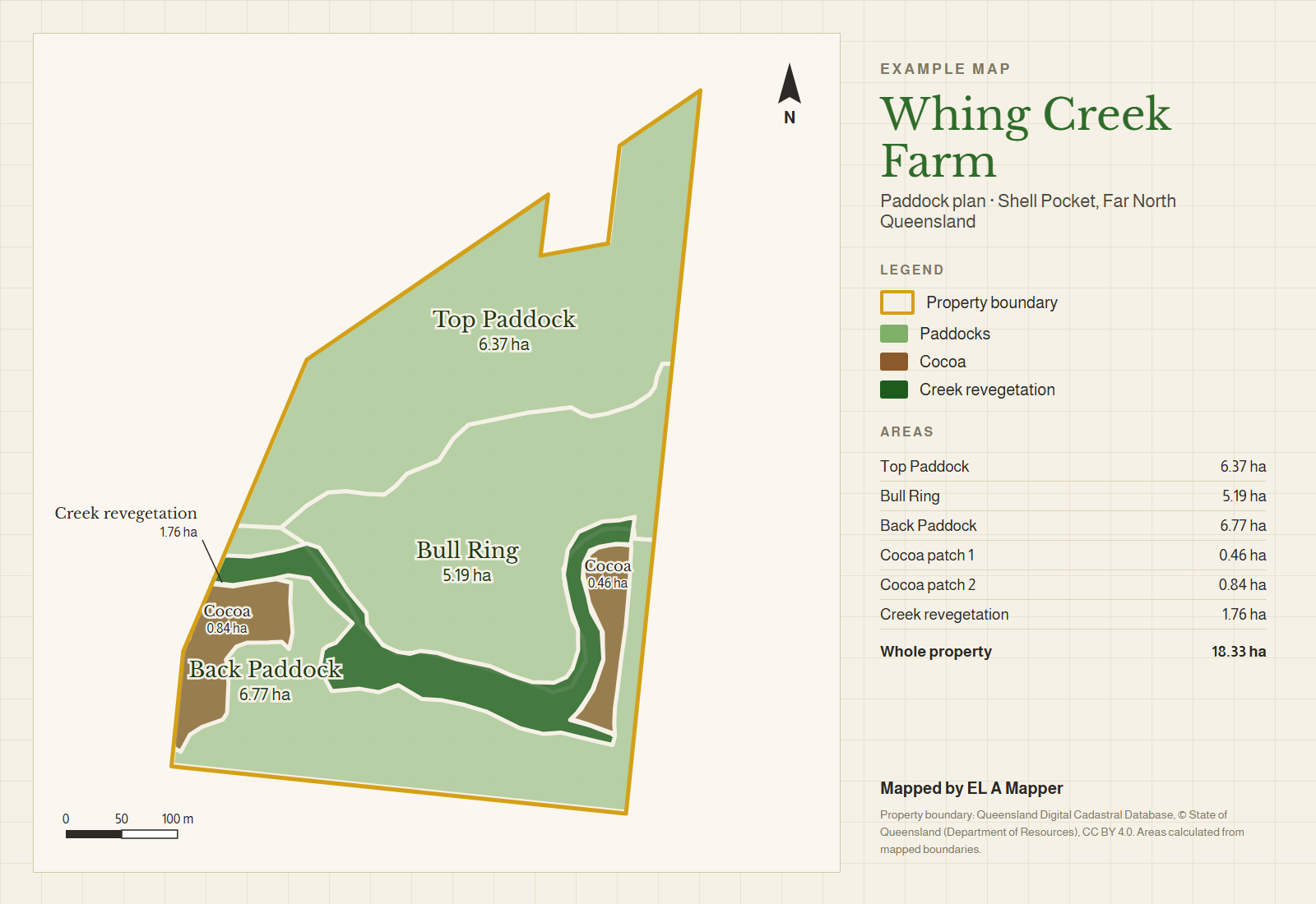
Paddock plan: paddocks, cocoa and creek revegetation at Whing Creek Farm, with measured areas.

Learn to map it yourself
Practical Farm Mapping is my online course using free Google tools: Google Earth Pro and Google My Maps. Short, plain-English lessons, a practice farm file and printable cheat sheets. No GIS experience needed.
Free download
Grant-Ready Map Checklist (PDF): check your map against what grant assessors look for before you submit.

How it works
Tell me about your property or project.
I'll suggest an approach and give you a quote.
You get maps you can use straight away, as a PDF and a Google Earth file.
I work remotely, so distance isn't a problem.
