
Grounded in Country,
Welcome to Far North Futures, where our family brings together traditional wisdom, regenerative practices, and cutting-edge mapping technology. From our roots to our life in Far North Queensland, we are passionate about creating a sustainable future that honours the land and supports our community. Meet the crew, Dad family man and cattle wrangler, and Mum as a mapper with a knack for aligning complex systems, we offer unique solutions for regenerative enterprises. Follow us as we walk feet on the land, empower families, and helping build resilient communities.

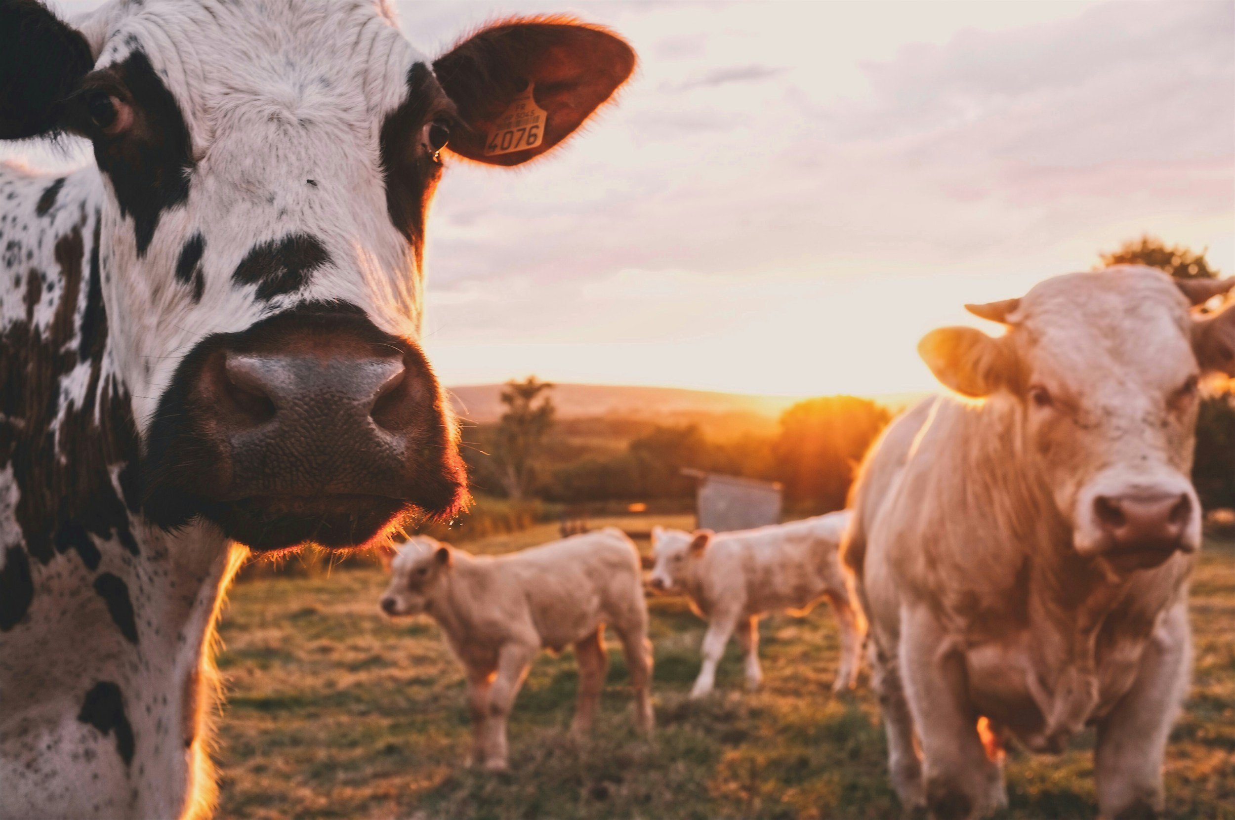
Grass-Fed Goodness Raised on Country
Our hormone-free, grass-fed beef is raised on rich country in Far North Queensland.
Ethical, sustainable, and packed with flavor, it’s the perfect addition to menus celebrating real food and meaningful connections.
We’re looking to partner with restaurants that share our values of respect for country and community. Let’s work together to bring better beef to your customers!
EMAIL us today to learn more or place an order.
#GrassFedBeef #CountryRaised #SupportLocalFarms

Quality Raised on Country
At Whing Creek Farm, we’re more than a farm; we’re a family on a mission. Inspired by our connection to the land and guided by the dream of first-generation land ownership, we proudly produce premium grass-fed, hormone-free beef raised with care and respect for the environment.
Every step we take is grounded in regenerative farming practices that heal the soil, nurture the animals, and honor the traditions that have shaped the land for generations. We also empower others through innovative farm management mapping solutions, offering tools to sustain and grow their own journeys.
Our story is one of resilience, passion, and purpose. From working remotely to support our dreams, to collaborating with like-minded chefs and farmers, we believe in creating a future where food, family, and sustainability thrive together.
Join us in celebrating ethical farming, meaningful connections, and the beauty of building something from the roots up. Together, we can make a difference—one meal, one map, and one dream at a time.
Nestled in the Heart of Far North Queensland
At Whing Creek Farm, our story unfolds in the stunning landscapes of Far North Queensland, on the rich and rugged lands of El Arish. Surrounded by rolling hills, fertile soils, and the whispers of ancient traditions, this is where our dream takes root.
El Arish isn’t just where we work; it’s where we live, learn, and grow. The land shapes everything we do, from raising our grass-fed, hormone-free cattle to practicing regenerative farming that nurtures the environment for future generations.
Far North Queensland offers more than breathtaking beauty—it’s a place of resilience, connection, and opportunity. From its diverse ecosystems to the vibrant communities we’re proud to be part of, El Arish inspires our commitment to sustainability and quality.
This is where our journey toward first-generation land ownership begins, and it’s where every bite of our beef tells a story of care, tradition, and innovation. We invite you to experience the richness of Far North Queensland through our work and our vision for a better future.